The Parish of St. Barts
and how to find us
Every street in England is in an Anglican parish. In rural areas it is usually very clear where one community ends and another begins. Often in urban areas there are no obvious dividing lines. Nor are parish churches situated right in the middle of their parish, so it is possible to be only a short distance from a church, but actually to be in a different parish!
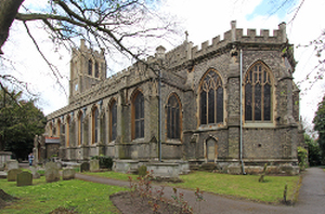
Nevertheless, these areas around a church are still used to define the parish for which each church has responsibility, and whose inhabitants may ask for baptisms, weddings and funerals.
Our parish is bounded on the east by the railway (following the site of the old Croydon Canal) and on the south by Crystal Palace Park Road, coming up to a point on Sydenham Hill. Then it turns down Kirkdale along the middle of the road, as far as Peak Hill, which it cuts across the railway again.
For a map showing the Parish Boundaries click Here or on the link to the right. This will open up a separate window and take you through to Google maps, as used by A Church Near You. Use the plus and minus signs to zoom in and out.
Streets included in the Parish
|
|
Call the Rev Stephen Edmonds on 020 8676 8925
--------------------
--------------------
through this page
--------------------
(opens in new window)
--------------------